Stage 5 · Working map
The Map
Every place in the day-by-day account, filterable by day. This is a modern base map — the georeferenced 1945 aerial imagery and traced front lines are the next step, not something shown here.
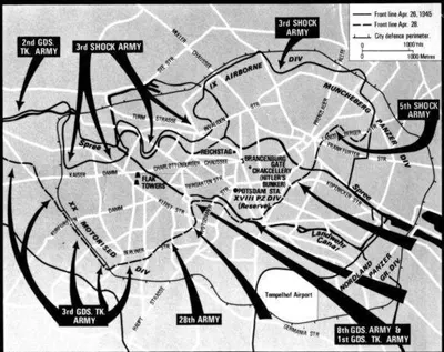
The Soviet plan of attack on the centre of Berlin - April 1945 rights unverified
56 places plotted. Coordinates carry an explicit precision: exact for a structure whose position is not in doubt, approximate for a street or waterway with extent, district for an area.
Modern base map © OpenStreetMap contributors. 1953 aerial imagery: Geoportal Berlin, Luftbilder 1953, Maßstab 1:22 000, Senatsverwaltung für Stadtentwicklung, Bauen und Wohnen — published without access restrictions.
There is no 1945 layer. Berlin’s surviving aerial surveys skip the war years, and 1953 is the closest available — eight years after the battle, with the Tiergarten still stripped bare and the government quarter still in rubble. Wartime Allied reconnaissance photography exists at the US National Archives but is not served as tiles by anyone; georeferencing it is Stage 5 proper.